Ranking Bhaskel Basin Sub-Watersheds for Erosion
Ranking Bhaskel Basin Sub-Watersheds for Erosion
In the relentless quest to address the escalating challenges associated with soil erosion, a cutting-edge study has emerged, illuminating new pathways for sustainable watershed management. Researchers P.R. Shekar and A. Mathew have unveiled a comprehensive framework for prioritizing sub-watersheds in the Bhaskel basin, employing a fusion of advanced morphometric analysis and multi-criteria decision-making (MCDM) techniques. Published in Environmental Earth Sciences, this pioneering work not only underscores the intricate interplay of geomorphological attributes governing erosion but also heralds a transformative approach to combating land degradation in sensitive ecological regions.
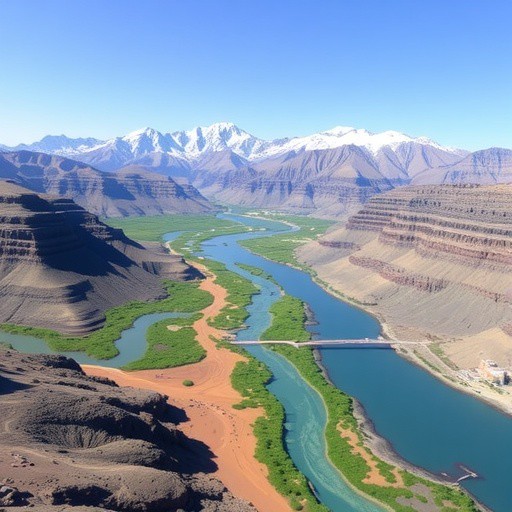
Soil erosion remains one of the most pernicious environmental issues worldwide, threatening agricultural productivity, water quality, and biodiversity. The Bhaskel basin, a critical hydrological unit embedded in a diverse topographical landscape, exemplifies the hotspots where unchecked soil loss can precipitate severe ecological and socio-economic consequences. Recognizing the urgency of targeted interventions, Shekar and Mathew’s research dissects the sub-watershed units into manageable segments whose vulnerability to erosion can be distinctly ranked, thus optimizing the deployment of conservation resources.
Central to the study’s methodology is the implementation of morphometric analysis—a quantitative evaluation of the basin’s geometric and topographic characteristics. This technique involves an exhaustive assessment of parameters such as drainage density, stream frequency, bifurcation ratio, and basin relief. By decoding these metrics, the researchers decipher the inherent hydrological and erosional dynamics that predispose certain sub-watersheds to heightened sediment mobilization. Such detailed morphometric profiling is fundamental to distinguishing the erosion-prone zones from more stable areas within the basin’s drainage network.
However, the true novelty lies in the integration of morphometric data with MCDM techniques, which allow for a holistic evaluation of sub-watersheds by aggregating multiple criteria into a unified ranking system. Multi-criteria decision-making models enable the assimilation of diverse indicators—ranging from physical drainage properties to socio-environmental factors—thus facilitating an objective prioritization schema. This methodological synergy propels traditional soil erosion assessment beyond conventional single-parameter analyses, offering nuanced insight tailored to the basin’s complex environmental gradients.
The research team meticulously delineated the Bhaskel basin’s sub-watersheds through high-resolution Digital Elevation Models (DEMs), employing Geographic Information Systems (GIS) platforms to extract topographical data with unmatched precision. Morphometric parameters were quantified using established geomorphological formulas, ensuring reproducibility and comparability with global studies. This data-rich foundation was pivotal for the subsequent MCDM analysis, where criteria weights were assigned based on expert judgments and statistical variance, reflecting the relative significance of each parameter in influencing soil erosion processes.
One of the pivotal findings reveals that sub-watershed areas characterized by steep slopes combined with high drainage density and elevated stream frequency exhibit a pronounced susceptibility to erosion. These geomorphological signatures accelerate surface runoff and sediment detachment, underscoring the imperative for stringent land management practices. Conversely, sub-watersheds with gentler slopes and lower drainage indices demonstrated comparatively resilient soil structures, highlighting natural zones of protection that can inform conservation priorities.
The implications of this ranking system are profound for policymakers and environmental managers in the region. By highlighting priority zones for intervention, the researchers provide
Moleculera Biosciences Poised for Major Breakthrough: A Closer Look at Its Pivotal Moment
Next PostStandardized Long-Term Care for Childhood Cancer Survivors
Related Posts

Exploring Nature-Based Solutions: A Multifunctional Approach
Evaluating Land Use Changes in Bangladesh’s Swamp Forest
Eco-Friendly Silver Nanoparticles from Jatropha for Wastewater Treatment
GIS-Based Land Use Analysis in Shimla’s Agroforestry
Predicting Landslides: Future Land Use and AI Models